
By Elly Leonida, FVP Operations Manager

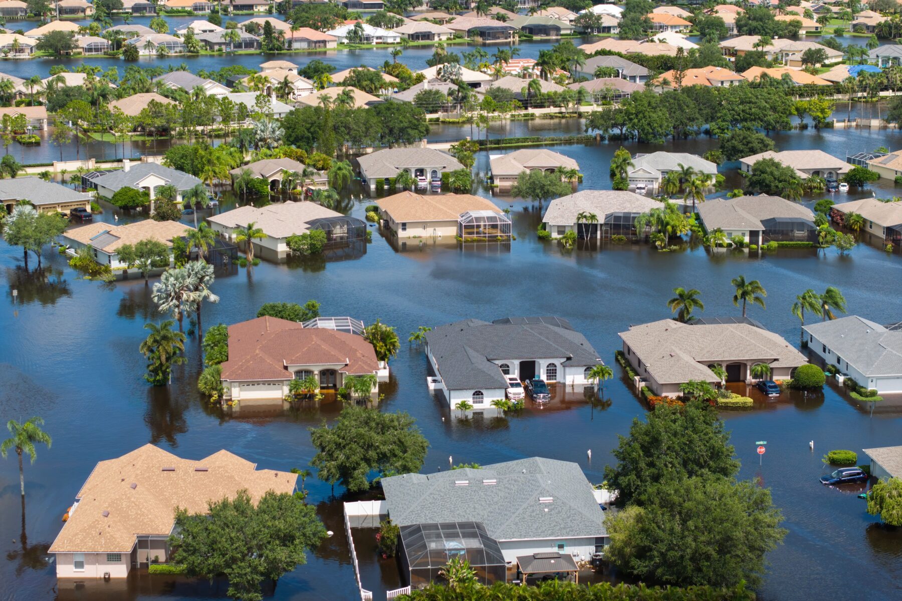
Over the past decade, advancements in technology and automation have transformed the mortgage industry, streamlining loan approvals, processing, and closings while enhancing speed, accuracy, and customer experience. These improvements extend to flood certification, a critical requirement for every home loan. While automation enables LERETA to deliver immediate and accurate flood zone determinations for over 93% of mortgage applications, the remaining 7%—exceptions—require specialized handling. This percentage may be even higher for providers lacking cutting-edge technology. Additionally, changes in FEMA flood maps can alter homeowners’ flood risk determinations, making exception management essential.
The Impact of FEMA’s Risk Rating 2.0
Introduced on October 1, FEMA’s Risk Rating 2.0 transformed flood risk assessment for policies renewed after April 1. Leveraging industry best practices and advanced technology, it provides precise flood risk evaluations for individual properties. However, flooding remains the most common natural hazard in the U.S., affecting all 50 states through flash floods. With FEMA issuing revised flood zone maps twice monthly, exceptions are inevitable and require expert attention to ensure accurate outcomes.
Why Exceptions Matter
LERETA collaborates with lenders and insurance companies of all sizes to maximize automation for straightforward flood certifications while expertly managing exceptions. Proper exception handling is critical because:
- Revised FEMA maps can shift a property’s flood zone status, requiring homeowners to carry flood insurance if newly designated in a Special Flood Hazard Area (SFHA).
- Unique property features, such as elevation (e.g., a home on a mountain) or construction enhancements (e.g., raised elevation with earthen fill), may exempt a property from flood insurance or qualify it for reduced rates.
- Proactive management of exceptions can differentiate lenders, ensuring compliance and customer satisfaction.
Leveraging the LOMA Option
For many exceptions, a Letter of Map Amendment (LOMA) or Letter of Map Revision (LOMR) issued by FEMA can resolve discrepancies. A LOMA addresses individual properties, while a LOMR applies to larger areas like subdivisions. However, many homeowners and lenders lack awareness or expertise to navigate the LOMA process. LERETA bridges this gap by:
- Guiding homeowners through the detailed LOMA application process at no additional cost to lenders or homeowners.
- Assessing eligibility for a LOMA before starting the process, ensuring efficiency.
- Managing all required documentation, which may include:
- LOMA application form.
- Property’s year of construction.
- Elevation certificate from a licensed land surveyor or registered professional engineer, confirming the lowest adjacent grade is at or above the Base Flood Elevation.
- Plat/parcel map and FEMA Flood Insurance Rate Map with aerial imagery.
- Recorded property deed.
- Confirmation of fill placement (yes or no).
The traditional LOMA process can take up to six weeks, but FEMA’s eLOMA, a web-based tool, accelerates submissions while still requiring meticulous documentation. LERETA’s expertise ensures all requirements are met for successful outcomes.
Proactive Tools for Flood Certification
LERETA provides innovative solutions to stay ahead of flood certification challenges:
- Life-of-loan flood zone tracking: Monitors changes in a property’s flood status for new loans or existing mortgages, ensuring timely updates.
- Probability scans: Deliver over 99.9% accurate predictions of flood certification status changes before FEMA map revisions take effect, reducing processing time from over a month to a few days. This tool benefits:
- Lenders seeking proactive insights.
- Insurance carriers identifying homeowners needing flood insurance for targeted marketing.
- Dedicated GIS team: Specializes in managing exceptions, working directly with homeowners to resolve issues and secure LOMAs.
- Certified floodplain managers: Three team members, certified annually through the National Flood Insurance Program, bring unparalleled expertise to flood determinations.
LERETA’s Commitment to Excellence
LERETA’s success stems from a focus on details, combining innovative technology with experienced teams to manage exceptions effectively. Key differentiators include:
- Advanced automation: Ensures immediate, accurate flood determinations for over 93% of applications.
- Exception expertise: Handles the 7% of cases requiring specialized attention, including LOMA applications and map revisions.
- Customer-centric approach: Provides no-cost support for rechecks, rushes, and homeowner assistance, regardless of client size.
- Industry leadership: Digitizes FEMA’s twice-monthly map updates to maintain consistent accuracy.
By prioritizing both automation and exception management, LERETA elevates the customer experience and drives successful outcomes in flood and tax servicing.
Why Choose Lereta
To explore how LERETA manages flood certification details, visit our Advanced Flood Tracking & Certification page.

The Stakes in Commercial Real Estate Investing are Higher Than Ever: Why Investors and Subservicers Should Pay Close Attention to Property Tax and Flood Servicing

Navigating the Tax Terrain — Why Local Nuance Demands National Expertise
New Tools, New Rules: How FEMA is Making Flood Insurance Easier for Homeowners